
The Kanchenjunga Region sits in the far northeast corner of Nepal, on the border with Sikkim (India) and close to Tibet. It is home to Mount Kanchenjunga (8,586 m), the third-highest mountain in the world, and it is one of the quietest and most demanding trekking regions in the country.
This guide explains where the trek goes, the best time to go, how to get there, which permits you need and how to plan a realistic itinerary. It is written for trekkers who want long days, wild scenery and real mountain culture rather than busy trails.
| Location | Taplejung District, eastern Nepal |
| Main peak | Mount Kanchenjunga, 8,586 m |
| Highest trek point | Pangpema (North Base Camp), about 5,140 m |
| Typical duration | 20–22 days for the full circuit; 14–16 days for North or South only |
| Difficulty | Strenuous. Long days, high passes and remote terrain |
| Best seasons | March–May and September–November |
| Permits | Restricted Area Permit and Kanchenjunga Conservation Area Permit |
| Accommodation | Accommodation |
Most of the trek runs through the Kanchenjunga Conservation Area, a protected landscape that rises from subtropical forest and terraced farmland to alpine meadows, glaciers and high-altitude wilderness. The border zone is a restricted area, which is why the trek has stayed far less crowded than Everest or Annapurna.
The region is also culturally varied. Limbu and Rai communities live in the lower valleys, while Sherpa and Tibetan-influenced villages appear higher up. Walking from one to the other is a big part of what makes the trek memorable.
Why trek Kanchenjunga?
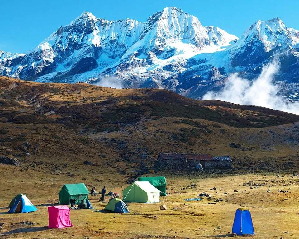
The region’s centerpiece. Its summit ridge, hanging glaciers and neighboring peaks dominate the skyline for much of the trek, and the mountain is considered sacred by local communities.
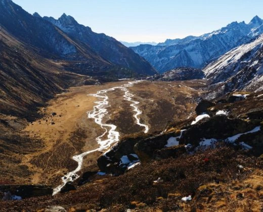
Pangpema (about 5,140 m) gives a close view of the north face of Kanchenjunga. The approach follows the Ghunsa valley through Kambachen and Lhonak, across alpine terrain and glacial moraine. It is the high point of most Kanchenjunga itineraries.
Oktang (about 4,730 m) in the Yalung Valley is the main viewpoint for the southern side of Kanchenjunga, with views of the Yalung Glacier and surrounding peaks. It is usually reached from Ramche on the second half of the circuit.
The crossing between the Ghunsa (north) and Yalung (south) valleys includes Sele La and, depending on the route, Sinion La, Mirgin La and Sinelapche La. These passes sit roughly between 4,200 m and 4,700 m. They are long, demanding days that depend on good weather and an experienced guide.
The largest settlement on the northern route (about 3,500 m). Ghunsa has Tibetan-influenced culture, stone houses, prayer flags and a monastery. It is also the main acclimatization stop before Pangpema.
These high settlements lie on the final approach to Pangpema. Kambachen is a summer yak-herding village, and Lhonak sits beside a glacial lake with open mountain views. Facilities are very basic.
A separate, more remote trekking option. Olangchung Gola is a traditional trading village on the old route to Tibet, and the Yangma Valley offers forest trails, yak pastures and isolated settlements. These routes need extra logistics and are not part of the standard base camp circuit.
A demanding extension that links the Kanchenjunga region with the Makalu region through high, remote terrain. It is suitable only for experienced trekkers with strong support and a flexible schedule.
| North Base Camp (Pangpema) | South Base Camp (Oktang) | |
|---|---|---|
| Starting area | Sekathum or Ghunsa side | Yamphuding side |
| Highest point | About 5,140 m | About 4,730 m |
| Typical duration | 14–16 days | 12–15 days |
| Scenery | Glacier valleys, high alpine terrain, Tibetan-influenced villages | Rhododendron forest, ridges, Yalung Glacier views |
| Best for | Trekkers wanting the highest, wildest sections | Trekkers wanting a slightly lower, forested route |
Many trekkers combine both in the full Kanchenjunga Circuit, which crosses the high passes between the two valleys.
There is no direct road or flight to the mountains. Most trekkers use this route:
Some charter or small-aircraft options to the Taplejung area may exist, but schedules are irregular. Always confirm before relying on them, and add buffer days for road delays, especially in the monsoon.
Spring and autumn are the best seasons for trekking in the Kanchenjunga Region.
Spring (March–May)
Autumn (September–November)
Winter (December–February)
Monsoon (June–August)
For most trekkers, March–May and September–November offer the best balance of weather, visibility and trail conditions.
| Day | Route | Note |
| 1 | Kathmandu to Bhadrapur (flight), then drive to Ilam or Birtamod | Overnight in eastern Nepal |
| 2 | Drive to Taplejung (Phungling) | Long mountain road |
| 3 | Drive to Sekathum, trek to Amjilosa | First trekking day |
| 4-5 | Amjilosa to Gyabla, then to Ghunsa | Gradual climb through forest |
| 6 | Acclimatization day in Ghunsa | Short walks, monastery visit |
| 7 | Ghunsa to Kambachen | Higher, more open terrain |
| 8 | Kambachen to Lhonak | Altitude gain, short day |
| 9 | Lhonak to Pangpema and back | North Base Camp day trip |
| 10-11 | Return to Ghunsa, with a buffer day | Weather and recovery |
| 12 | Ghunsa to Selele | Start of the high passes |
| 13 | Selele to Cheram (via the passes | Long and demanding day |
| 14 | Cheram to Ramche | Enter the Yalung Valley |
| 15 | Cheram to Ramche | South Base Camp viewpoint |
| 16-17 | Ramche to Torontan, then to Yamphuding | Descent into forest and villages |
| 18-19 | Yamphuding to the road-access area, drive toward eastern Nepal | Depends on road conditions |
| 20-22 | Fly or drive back to Kathmandu, with buffer days | Spare days for flights and weather |
This is an indicative plan for the full circuit. Real schedules depend on road access, weather, acclimatization and your operator’s route.
This is a planning framework, not a fixed schedule. A final itinerary should include realistic walking times, rest days and weather buffers.
Limbu and Rai communities are prominent in the lower valleys, while Sherpa and Tibetan-influenced traditions appear in the higher villages. Expect prayer flags, chortens and small monasteries along the route.
Food you are likely to find
Travel respectfully. Ask before photographing people and follow local guidance at religious sites.
Accommodation is basic and gets simpler with altitude.
Hot water, charging and food choices vary, and some lodges may be closed outside peak season. Confirm accommodation arrangements with your agency before you travel.
Kanchenjunga is a restricted trekking region. Permits are arranged through a government-registered Nepali trekking agency, and you cannot trek independently.
Issued by the Department of Immigration through your agency. Published fees for the Taplejung restricted area are:
A three-week trek therefore costs about USD 60 per person in RAP fees.
Required for entry to the conservation area, per person per entry:
| Category | Fess |
|---|---|
| Nepali nationals | NPR 100 |
| SAARC nationals | NPR 500 |
| Foreign nationals | NPR 2000 |
| Children under 10 | Free |
Restricted Area Permits are generally not issued for solo trekkers. Expect to travel in a group of at least two with a licensed Nepali trekking guide. Your agency will confirm whether any additional registration, such as a TIMS card, applies to your route.
Permit fees and rules can change. Check the latest requirements with your agency or the issuing authority before confirming a trek or publishing package prices.
Practical tips
Safety tips
Kanchenjunga is remote, and rescue can take time. Good preparation, a realistic itinerary and experienced local support are essential.
How long does the Kanchenjunga trek take?
The full circuit takes about 20–22 days including travel and buffer days. North or South Base Camp alone takes roughly 14–16 days.
How hard is the Kanchenjunga trek?
It is strenuous. The days are long, the region is remote and the high passes need good fitness and acclimatization. Previous multi-day trekking experience is strongly recommended.
Can I trek Kanchenjunga solo?
No. Restricted Area Permits require a licensed guide and, generally, a group of at least two trekkers.
How much do the permits cost?
The RAP is USD 20 per person per week for the first four weeks, and the KCAP is NPR 2,000 for foreign nationals. Confirm current fees before you travel.
Is Green Lake part of the Nepal trek?
No. Green Lake is on the Indian (Sikkim) side of Kanchenjunga and is not part of the Nepal base camp trek.
Kanchenjunga is for trekkers who want solitude, big mountains and a real wilderness journey. Ghumnajaau can help you choose the right route, arrange permits and build a safe, realistic itinerary for the Kanchenjunga Himalayas.



We create unforgettable trips, customized for your group.